


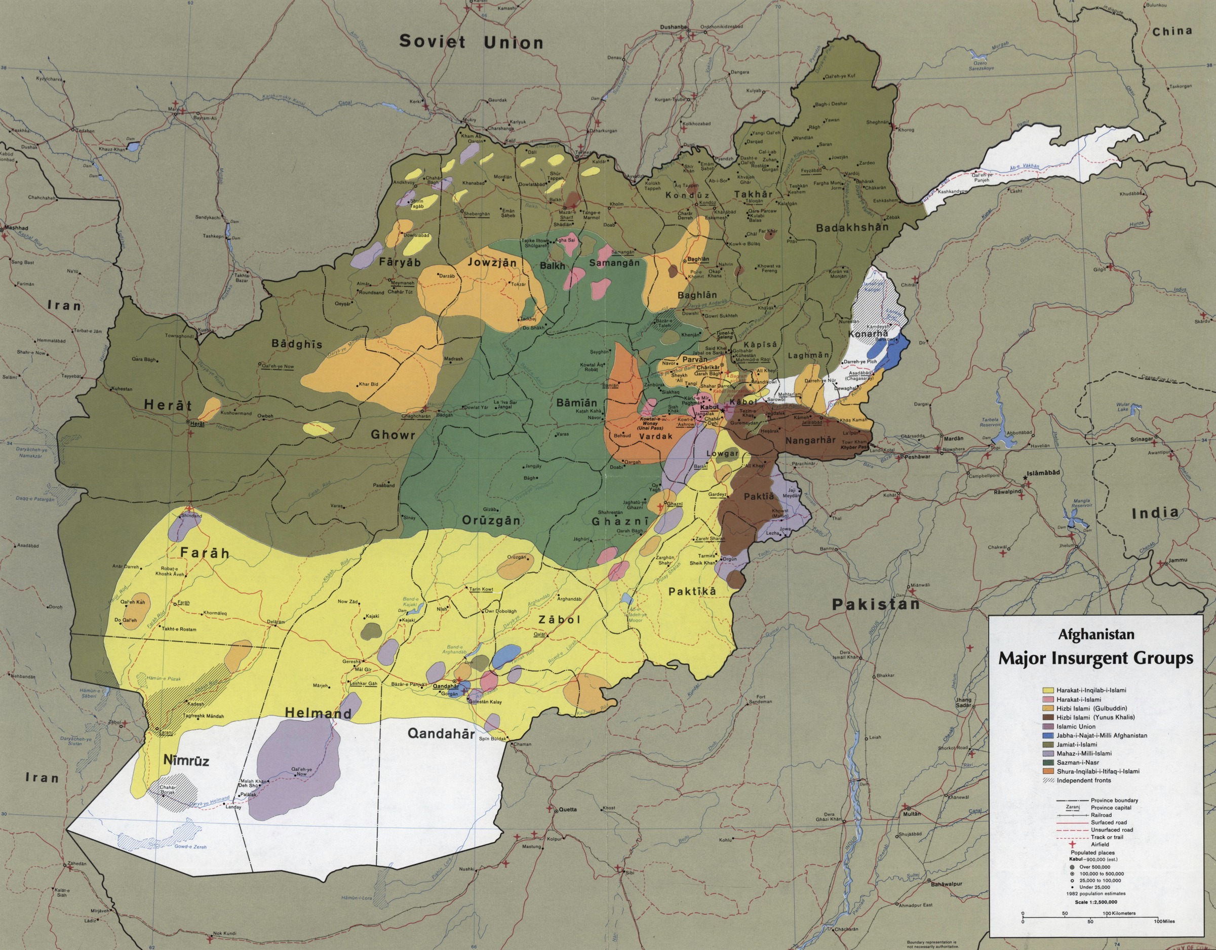
CIA map showing the areas where the main Mujahideen factions operated in 1985, during the Soviet war in Afghanistan. Scale 1:2,500,000 (E 600–E 750/N 380–N 290). Date: September 1985. Author: Central Intelligence Agency/US Federal publication. Public Domain. Source: Wikimedia Commons.
Forside Afghanistan – krig og besættelse / War and Occupation (1979-2021) CIA map showing the areas where the main Mujahideen factions operated in 1985, during the Soviet war in Afghanistan. Scale 1:2,500,000 (E 600--E 750/N 380--N 290). Date: September 1985. Author: Central Intelligence Agency/US Federal publication. Public Domain.
CIA map showing the areas where the main Mujahideen factions operated in 1985, during the Soviet war in Afghanistan. Scale 1:2,500,000 (E 600–E 750/N 380–N 290). Date: September 1985. Author: Central Intelligence Agency/US Federal publication. Public Domain.


